


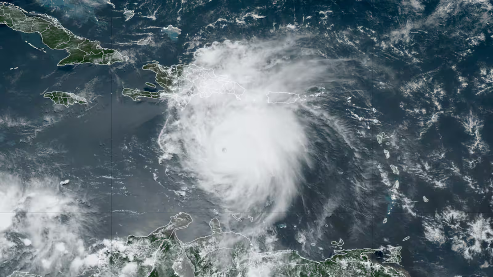
Hurricane Beryl’s unprecedented intensification into a Category 5 storm has shocked meteorologists and highlighted the dire conditions anticipated for the 2024 hurricane season. Experts were already on high alert, given the numerous warning signs leading up to the formation of Beryl.
The storm rapidly developed, hitting Grenada and Carriacou as a Category 4 before escalating into a Category 5 as it moved through the Caribbean. Beryl is expected to continue its destructive path, potentially impacting Jamaica and Mexico’s Yucatán Peninsula.
The early timing and rapid intensification of Beryl have set several records, occurring far before the typical peak of the hurricane season. It is the earliest recorded Category 4 and 5 storm in the Atlantic, surpassing previous records set by storms Dennis and Emily in 2005.
Additionally, Beryl formed farther east in the Atlantic than any other hurricane this early in the season, signaling significant anomalies in the ocean’s conditions. These milestones are alarming indicators of the severity of this year’s hurricane season.

Hurricane Beryl’s Unprecedented Strength Signals a Dangerous 2024 Hurricane Season
Beryl’s formation and growth were fueled by exceptionally warm sea surface temperatures, ranging from 28 to 30 degrees Celsius. These temperatures, usually seen in the peak months of August and September, provided the energy needed for the storm to reach its maximum potential.
The Atlantic Ocean’s elevated temperatures have been consistent for over a year, setting new records throughout 2023 and continuing into 2024. This prolonged heat has created an environment ripe for intense hurricanes.
Ocean heat content (OHC), which measures the depth and extent of warm water, has been unusually high across the tropical Atlantic and Caribbean. This higher OHC allows storms to maintain their strength by limiting the cooling effect of churned-up deeper waters.
These conditions are expected to persist, enhancing the potential for more high-end storms as the season progresses. Forecasts from NOAA and Colorado State University predict an aggressive hurricane season, with up to two dozen named storms anticipated.
The formation of Beryl early in the season serves as a stark warning of the potential for more devastating storms. Besides the warm sea temperatures, factors such as organized thunderstorms, low wind shear, and ample atmospheric moisture are critical for hurricane development and are expected to be prevalent.
The possible development of La Niña could further decrease wind shear, making the Atlantic even more conducive to powerful storms. Coastal residents are urged to prepare now by assembling emergency kits and evacuation plans to mitigate the impact of future hurricanes.